Military Town Plans were specially produced 1:25,000 scale maps with overprinted and colour-keyed critical facilities notations that were created to be used by organised groups of civilian and military personnel during re-entry and rescue operations. They had unique features that resulted in their being considered as classified documents thus restricting their availability to those who were security cleared and with a “need-to-know”.
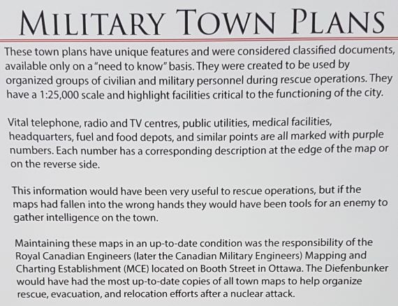
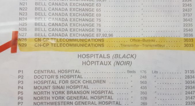
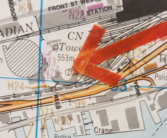
Overprinted on the map surface in a various colours were numbers and letters representing critical facilities necessary to the functioning of the city. Vital telephone and radio and TV centres, public utilities, medical facilities, headquarters, fuel and food depots and similar points were all marked with these purple numbers. Each number was then keyed to a description of a point of interest located either at the edge of the map or printed on the reverse side.
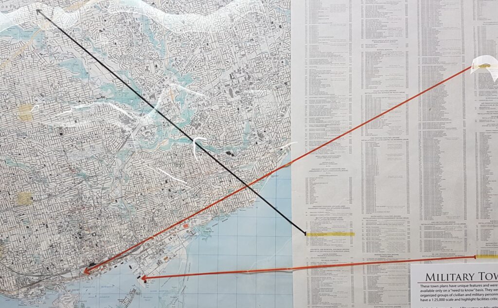
This information would have been very useful to re-entering rescue columns. Conversely if the maps had fallen in to the wrong hands it would have been a useful intelligence tool for the “enemy” by providing them with a “menu” of vital installations. Originally these maps were classified. Maintaining these maps in an up-to-date condition was the responsibility of the Royal Canadian Engineers (later the Canadian Military Engineers) Mapping and Charting Establishment (MCE) located on Booth Street in Ottawa
In the late-1950s, military and civil defence authorities became concerned over the lack of standard current mapping for the larger Canadian cities. The Army Survey Establishment was tasked to provide large scale mapping of 16 major cities that had been identified as possible nuclear targets. The city map series (called ‘Military Town Plans’ at the time) was designed at the scale of 1:25,000 to cover each selected city to a radius of 20 miles from the city centre. Because of the urgent nature of the work, contracts were arranged with civilian air survey firms to carry out some of the fieldwork and most of the map compilation. The initial 16-city requirement was completed in two years and the mapping of major Canadian urban centres then became an on-going commitment with revised maps required on a five-year cycle. Additional cities were added to the list until it included 44 cities and required 51 sheets.
(Extracted from ‘The History of the Canadian Military Engineers Volume III’, K.J. Holmes, LCol (Retd), Published by The Military Engineering Institute of Canada, 1997)